New geohazard tool allows emergency responders to reach disaster areas more quickly and efficiently
Every year, 108 million people fall victim to disasters arising due to extreme weather events. That is more than 6 times the total population of the Netherlands each year. Climate-related disasters include storms, floods, and extreme drought. Humanitarian emergency responders mobilise immediately after a disaster to provide necessary assistance to those affected in the disaster area as soon as possible. Due to the lack of up-to-date information, it is still not always possible to reach a disaster area quickly and efficiently.
When disaster strikes, three questions are crucial for aid workers: Which areas are hardest hit? Who is affected? How many people are affected?
Unfortunately, the answers to those questions are rarely readily available. The latest information on an area’s accessibility, and on the state and accessibility of important facilities in the area is also often lacking. Which roads and paths are still passable? Are hospitals, airports, and food distribution points still intact and accessible? Who are the affected people, and are they among the most vulnerable?
Multiple attempts needed to reach disaster area
Due to the lack of up-to-date information, initial attempts to reach a disaster area often fail. This causes delays in getting emergency aid underway and puts aid workers at unnecessary risk in dangerous situations. Victims in the disaster area are cut off from essential emergency aid such as food, safe drinking water, shelter, medicine, and sanitation for longer than desired.
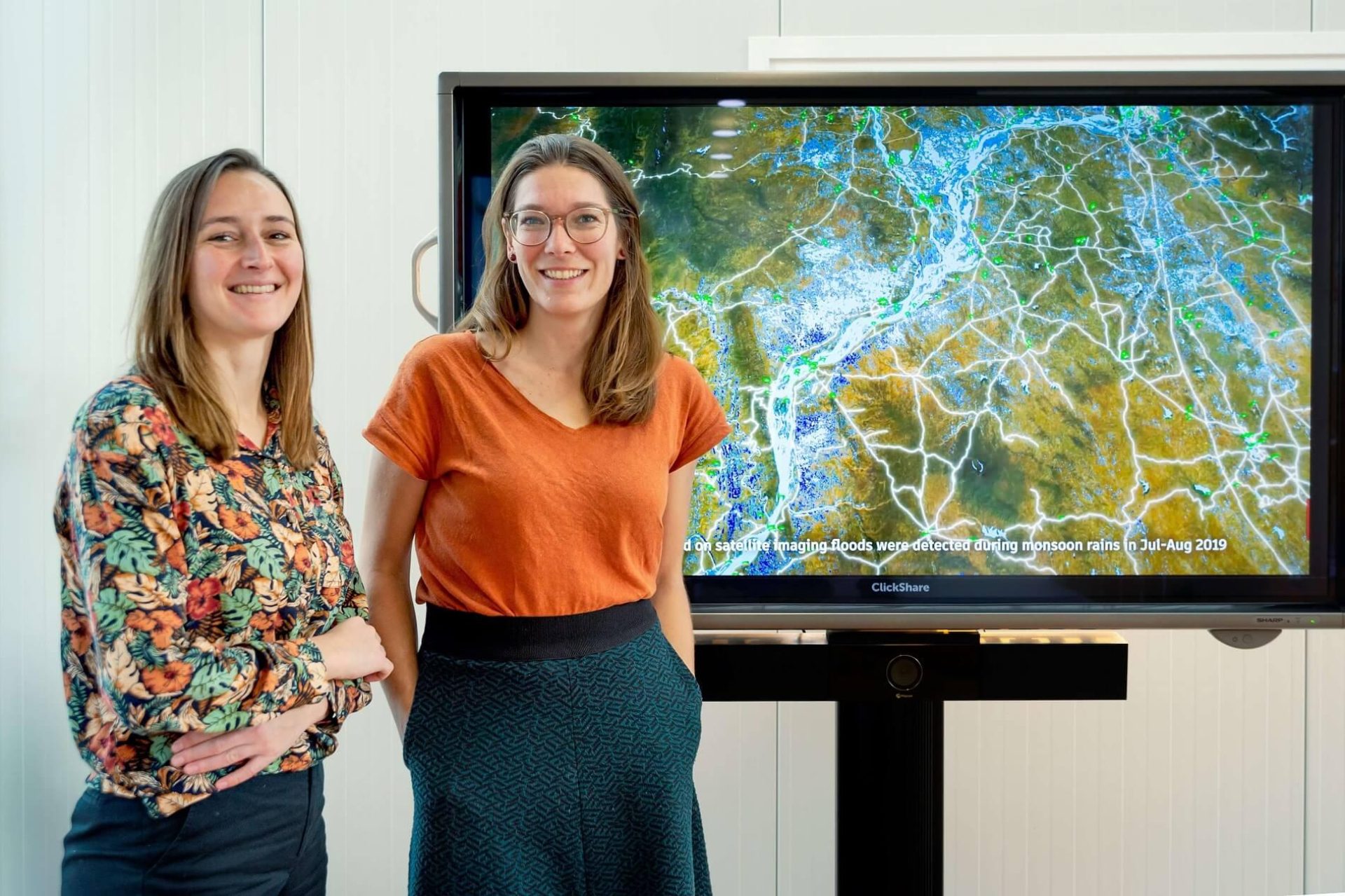
Deltares experts Frederique de Groen and Margreet van Marle participated in the World Food Programme’s (WFP) ‘Innovation Accelerator Bootcamp’. They pitched a design concept of a prototype based on the Deltares impact modelling tool ‘RA2CE’, that allows emergency responders to humanitarian disasters to reach disaster areas more quickly and efficiently. The WFP selected their pitch out of 650 submissions for further development. Frederique and Margreet will travel to Nepal soon to further develop the concept and test it on site.
Innovative prototype
The innovative prototype, which Deltares will develop further with the WFP team in Nepal, focuses on immediately providing the crucial information. Emergency responders need this information in the first 3 days (72 hours) after a flood disaster, to be able to respond much more quickly and efficiently.
Network model RA2CE basis
The Deltares network model RA2CE will form the prototype’s basis. RA2CE was originally created to develop adaptation strategies that can climate-proof infrastructure networks. Frederique and Margreet devised a new application of existing analyses in RA2CE. This allows them to, immediately after a disaster, identify which roads and/or paths are accessible or disrupted, which points of interest (such as hospitals and food distribution points) are still accessible, and where the affected population is located.
Cooperation WFP Nepal
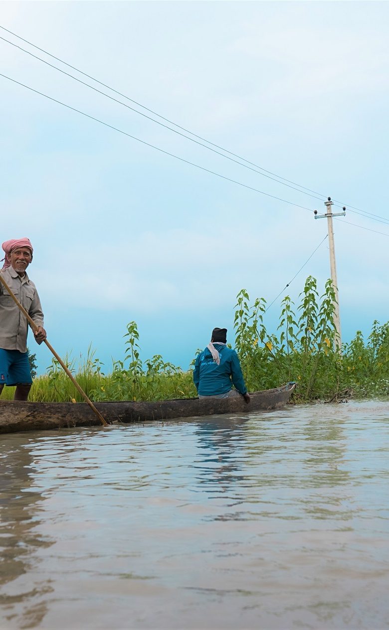
Also in Nepal, victims in disaster areas have been cut off from essential emergency relief for much longer than desired. This was the case for example during the 2015 in the large-scale disaster resulting from a major earthquake, but also in annual ‘smaller’ disasters, such as regional floods during the monsoon season. Unsurprisingly, it is in Nepal that the prototype will be tested. Soon, Frederique and Margreet will travel to Nepal. Together with the WFP Nepal office, they will further develop the prototype and test it onsite. Stakeholders and end-users are thereby involved in every step of the process, contributing significantly to its success.
I feel proud and honored to work on this project because we can potentially fulfil our dreams of applying the technology we have been working on to helping those most in need!
Frederique de Groen
Future
The prototype has great potential to grow into a highly relevant and globally deployable tool with great impact. Climate change is resulting in changes to weather patterns; this leads to more periods of extreme rain and therefore more flooding. In a bad scenario, the number of people in need of humanitarian aid due to natural disasters could almost double in the next 30 years.
The prototype can also provide insights for long-term planning of resilient infrastructure and even better preparation for future emergencies by identifying most disaster-prone areas in advance.
This co-creation enables us to give meaning to our modeled data in humanitarian response
Margreet van Marle