FRESHEM: Research into fresh water infiltration in Zeeland
FRESHEM Zeeland (FREsh Salt groundwater distribution by Helicopter ElectroMagnetic survey in the Province of Zeeland) looks at where fresh and salt water are located in Zeeland, and at what depth. This information can help farmers and market gardeners to meet their increasing need for fresh water.
As well as making it clear where the fresh water is located, the survey will, above all, indicate the areas that are most promising in terms of the infiltration of fresh water: this is water that can be used again later for crops.
FRESHEM Zeeland is a study programme involving Deltares, TNO and BGR (the Bundesanstalt für Geowissenschaften und Rohstoffe).
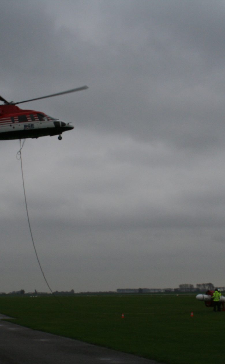
The Helicopter ElectroMagnetic (HEM) system
The data are collected using a helicopter that has been fitted out with a ‘cigar’. This is a measuring unit that is suspended below the helicopter and that uses five different frequencies to send an electromagnetic signal into the ground. That signal is picked up again by the measuring unit.
What actually happens is that the coil generates an electromagnetic field that is changed in the subsurface. This interference is measured using the system, providing an indication of the level of conductivity in the subsurface and the groundwater.
The technique
The conductivity of groundwater is an indicator of the salt level: salt water is a better conductor than fresh water. The HEM system (‘the cigar’) below the helicopter measures the electrical conductivity in the subsurface (for example: clay is a better conductor than sand and fresh water is a better conductor than fresh water) in combination with the electrical conductivity of the groundwater.
In order to draw conclusions about the salt level in the groundwater, then, this signal still has to be broken down to determine the electrical conductivity of the subsurface and the electrical conductivity of the groundwater.
We know a great deal about the geology of Zeeland and that allows us to determine the conductivity of the groundwater. However, ground measurements with information about the salt level of the groundwater can also help to split the signal. The next step is to ‘convert’ the conductivity of the subsurface into a chloride concentration for the groundwater.
Importance of the project for the stakeholders
- Comprehensive groundwater chart which is not currently available;
- What is the actual salt level, and where;
- Possibilities and opportunities for optimising saltwater management are clear;
- Optimising flushing procedures and raising awareness;
- An indication is obtained of the impact of salt water basins (as in the case of Grevelingen) on the groundwater system. This provides information for other basins that may turn salt in the future;
- Baseline situation established for salt-brackish-fresh distribution of the groundwater;
- Determination of a tendency towards salinisation or fresher water (repeat flights in 10 or 20 years);
- Basis for 3D groundwater models (and calibration);
- Improvement of fresh groundwater management in dunes (for drinking water extraction and threats).