Forecasting hurricane impacts in coastal areas
Hurricanes cause high winds, rain, storm surge and waves, which results in flooding, coastal erosion, damages to buildings and infrastructure and casualties among the population. The accurate forecasting of these events is essential to minimise these impacts.
As the only non-US partner, Deltares participates in the National Oceanographic Partnership Program on Hurricane Coastal Impacts. We are leading one of the modelling teams, in which we provide twice-daily forecasts of flooding, coastal erosion and damages during hurricane events. The other teams collect data from field sites or satellites, provide meteorological forecasts while two of other teams also apply models.
Software and model development
The challenge is to forecast hurricane impacts within a short time and for large areas. To make this possible Deltares developed the COastal Storm MOdelling System (COSMOSv2) consisting of SFINCS (surge and flooding), Xbeach (dune erosion and breaching) and FIAT (damage) models.
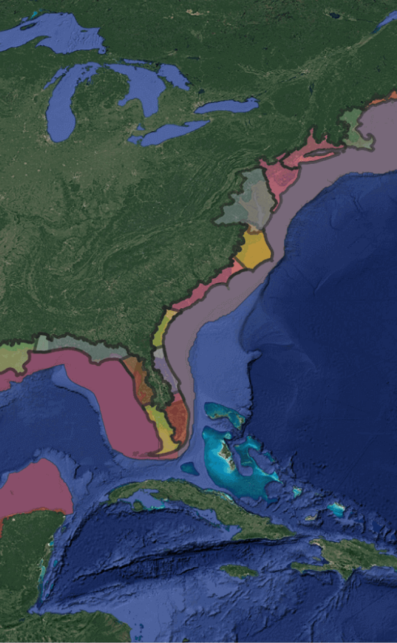
We take advantage of the computational speed of the SFINCS model, which allows for upscaling to continental scales. It is also the first time that Xbeach is applied along the entire coast in an operational setting because we made smart choices to reduce the computational demand of the model. As a result the modeled area now covers the entire US East and Gulf of Mexico Coast area.
In 2023 we successfully forecasted the impacts of Hurricanes Idalia, Ophelia and Lee. Especially Idalia caused damage and flooding on the Florida coast which we captured well.
The flooding and erosion are viewable on a dedicated website in which you can choose a scenario.
Including uncertainties
Hurricane tracks are notoriously difficult to predict. Therefore in 2024 we will include the uncertainties in flood extents due to hurricane track, speed and intensity variations. In this way we can deliver a more complete forecast for the 2024 hurricanes.
Forecasting is a balance between accuracy and speed. You want to make a good forecast, but it also has to be in time. Therefore, we use our fast flooding model SFINCS, which has been proven to be accurate and has the benefit of covering large areas within a few hours
Ap van Dongeren, coastal expert Deltares
Our knowledge with regards to forecasting hurricane impacts was used for Sint Maarten (Caribbean), Eastern Australia, Mozambique and Japan, where we applied SFINCS on large areas to be able to predict flooding due to surge, rainfall and waves. In Denmark, the SFINCS model is used to assess the flood risk along the complex coast of the entire country.
You have not yet indicated whether you want to accept or reject cookies. This means that this element cannot be displayed.
Or go directly to: