Forecasting Hurricanes on US Coasts
Every year between June and November, hurricanes threaten the Atlantic coasts of the US and the Caribbean. They cause high winds, rain and surge, and consequently, extensive flooding and coastal erosion. Causing casualties among the population and damages to buildings and infrastructure. It is important to understand the complex nature of the flooding process. This is due to the interaction between the ocean surge and rainfall. With this knowledge, we are able to make better models to forecast hurricane impact enabling life and property protection.

Check out the online viewer with the results
Deltares is part of a large research project under the flagship of the US National Oceanographic Partnership Program on Hurricane Coastal Impacts, consisting of 30 academic, government and industry partners to investigate how to best model these phenomena. We are leading one of the modelling teams in which we are tasked to provide twice-daily forecasts of flooding and coastal erosion during hurricane events. The other teams collect data from field sites or satellites, provide meteorological forecasts while two of the other teams also apply models.
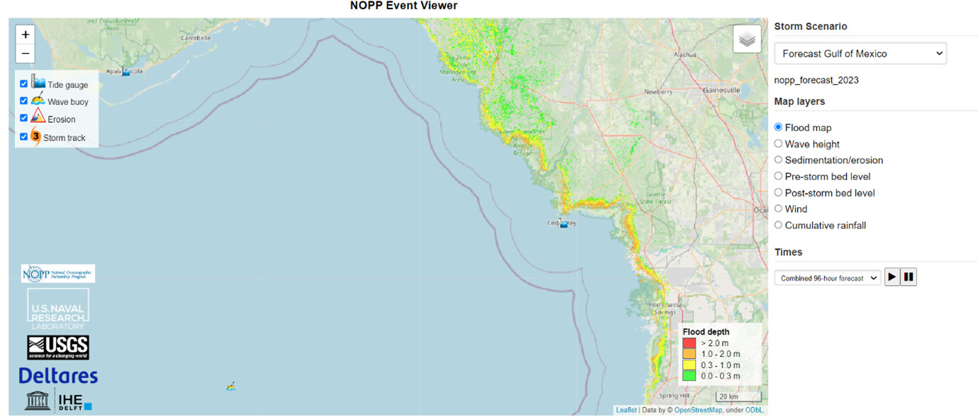
For this project, Deltares developed the COastal Storm MOdelling System (COSMOSv2) consisting of Delft3D (surge), SFINCS (surge and flooding) and Xbeach (dune erosion and breaching) models. These models cover the entire US East and Gulf of Mexico Coast, up to the 10 m elevation line.
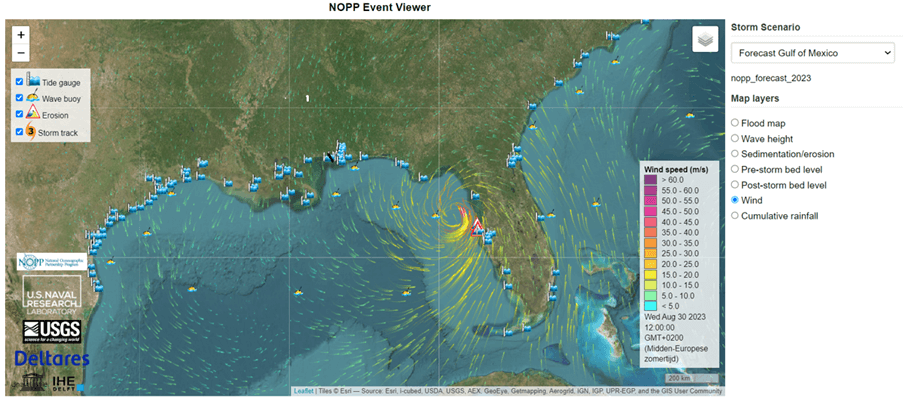
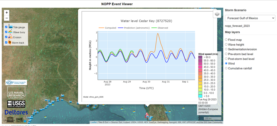
Probabilistic flooding forecast with wind variations for the entire US coast
For this hurricane season, we are able to produce probabilistic forecasts of flooding by running the models with variations in the wind input (ensemble modelling). It is also the first time that Xbeach is applied along the entire coast in an operational setting.
Forecasting is a balance between accuracy and speed. You want to make a good forecast but it has to be in time. Therefore, we use our fast flooding model SFINCS which has been proven to be accurate, but has the benefit that we can cover large areas and produce results in hours.
Ap van Dongeren, wave and morphology expert
All results are public and shown in an online viewer. You can find the archived results of the 2022 Hurricane Ian (which made devastating impact) by selecting “Hurricane Ian” in the storm scenario menu of the online viewer. Hurricanes of the 2023 season will be added to the online viewer in real time.
Follow-up of flood forecasting approach in other countries
This project has already produced spin-offs for applications in St. Maarten/St. Martin (Caribbean), Eastern Australia, Mozambique and Japan, where we apply SFINCS on large areas to be able to predict flooding due to surge, rainfall and waves. In Denmark, the SFINCS model is used to assess the flood risk along the complex coast of the entire country.