
The Updated Bays Eutrophication Model (BEM)
The Massachusetts Water Resources Authority (MWRA) manages a sewage system that collects wastewater from Greater Boston and sends it to the Deer Island Treatment Plant. The plant effluent is discharged through a new outfall farther offshore in Massachusetts Bay. At the time of implementation, this project constituted a major improvement for the water quality in Boston Harbor that used to receive the wastewater discharges.
Federal and state regulators require MWRA to maintain and annually run a Bays Eutrophication Model (BEM) as part of the assessment of the discharges’ ecological impact, next to water system monitoring.
The BEM is a combined water quality and hydrodynamics model; the water quality component simulates processes influencing phytoplankton, including nutrients, light, and potential effects on oxygen, and the hydrodynamic component simulates physical processes controlling water temperature, salinity, and circulation. Annual simulations have been made since the year 2000, with period modification of modelling methods in response to increasing system understanding, and enhanced software and hardware.
An updated BEM using Delft3D Flexible Mesh
In 2021, the “updated” BEM was completed, which makes use of Deltares’ Delft3D Flexible Mesh software. After the successful set-up and validation, the Updated BEM now serves to fulfil MWRA’s obligation to perform the annual simulations.
While developing the updated BEM, Deltares used a grid that captures the complex coastline, with spatially varying resolution. The updated model domain spans beyond the study area and includes the Gulf of Maine with its boundaries in deep water.
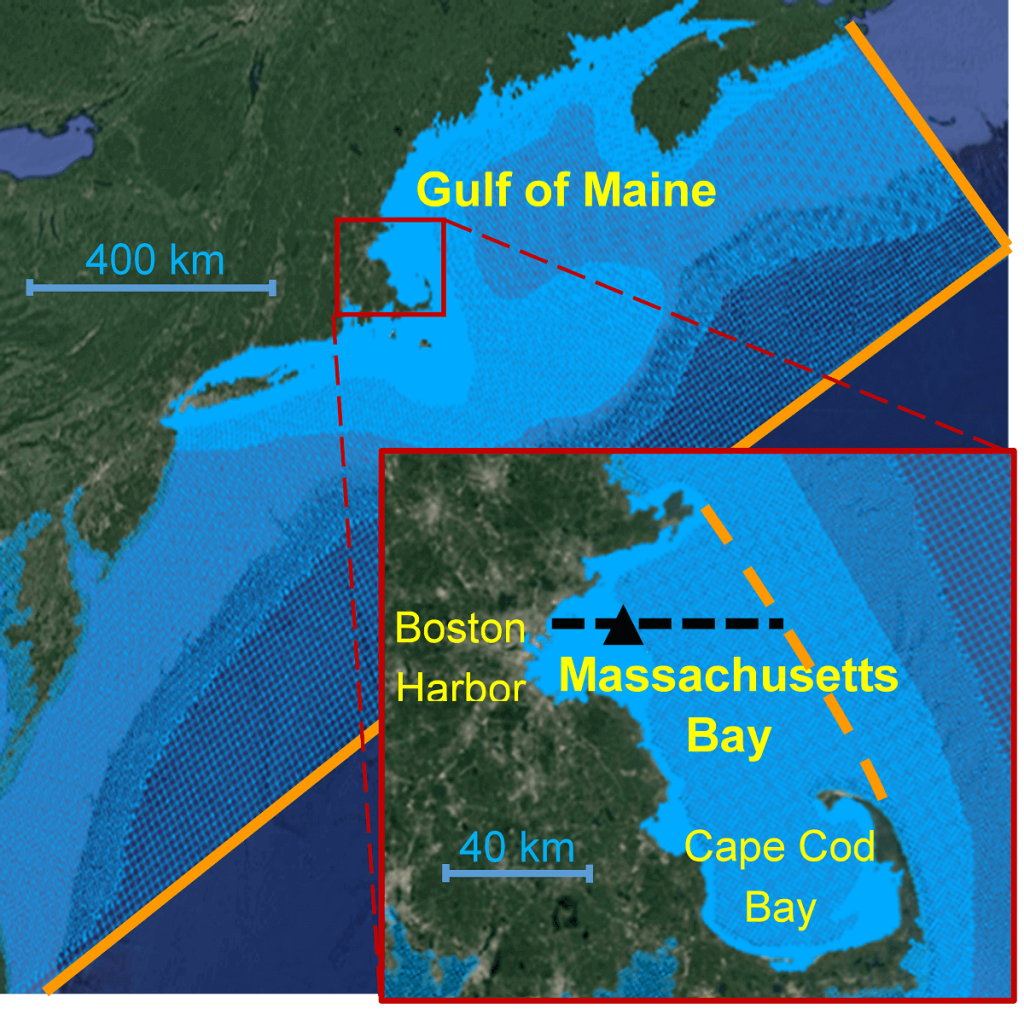
The updated BEM can more directly simulate the exchange between the bays and waters farther offshore. Its hydrodynamic component was demonstrated to reproduce physical processes well enough to provide a good representation of circulation patterns and stratification phenomena in the study area, both indispensable for sound water quality modelling. This approach has been shown to be successful also for the North Sea. Measured temperature and salinity are very well reproduced, even without using data assimilation.
The water quality component does not require measurements within the bays any more to derive model boundary conditions. The quality of the water outside the study area is simulated based on transport phenomena in the model domain, while nesting the deep-water boundaries in global data products. The calibration and validation were done while re-simulating the period 2012-2016 and showing comparable performance as the previous BEM, however, without the constraints of the assimilated salinity and temperature and a water quality model boundary close to the area of interest.

