12 frequently asked questions about high water on rivers
Expert(s) |
Johan Boon
|
Judith Kaspersma
The peak discharge of the Meuse in early 2023 was the highest discharge measured since records began in july 2021. The second and third highest discharges were in January 1926 and December 1993, when the peaks were in the same order of magnitude (between 3000 m3/s and 3300 m3/s). An overview of frequently asked questions and answers can be found below
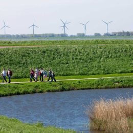
This high water in the Meuse was particularly exceptional because it occurred in the summer. In general, high water in the Meuse is a winter phenomenon. In summer, the floodplains are used much more and there is more vegetation. These factors affect the impact of high water and the water flow.
The extreme discharges in some tributaries of the Meuse were also striking, particularly in the Ourthe, Amblève, Vesdre and Lesse (all in the Belgian Ardennes). The joint discharges from these tributaries, and the fact that they occurred at more or less the same time, were a major factor in the high peak discharge in the Meuse. It should be pointed out the Meuse discharge from France (at Chooz) during this high-water period was relatively low. An even more extreme situation was therefore avoided.
The discharges from the Geul and Roer rivers, which converge with the Maas in the Netherlands, were also very high, leading to water nuisance in the Netherlands. The discharge of the Roer reached a level of 300 m3/s, as opposed to the 12 m3/s which is normal at this time of the year.
In the case of the Meuse Works Project (for flood risk management along this river), which has now been largely completed, the aim was to ensure that the banks of the Meuse could manage discharge levels comparable with the discharge peak of 3200 m3/s in mid-July. The dikes along the diked Maas (downstream of Boxmeer) have to be able to cope with a higher discharge level because a dike breach downstream of Boxmeer would lead to more severe flooding and potentially more damage and casualties.
The plan with the Delta Programme is to adapt the dikes further and give the rivers room so that we can manage higher discharges in the future without flooding.
The knowledge available at Deltares covers the following areas:
- The establishment of normative conditions for testing and designing flood defences on the Meuse
- Modelling water movements in the river
- Forecasting discharges and water levels during high water
- Modelling the different ways in which a dike breach may occur
- Estimating possible damage and numbers of casualties in the case of a major dike breach
- Determining standards (safety requirements) for flood defences
- Analysing the impact of climate change on discharges, and possible damage and casualties
- Considering alternatives to reduce the risk of flooding (such as Room for the River as opposed to the Meuse Works Project)
- Identifying trends and evaluating indicators to report on the effects of climate change
An overview of frequently asked questions and answers can be found below:
FAQ high water on rivers
How can heavy rainfall lead to flooding so quickly?
Heavy rainfall in the first half of July 2021 meant that the ground in the catchments of the various rivers in Germany, Belgium and the Netherlands was largely saturated. It was therefore largely unable to absorb the torrential rain that fell on 13, 14 and 15 July and so most of the water ran off. Because the catchments, particularly in Belgium and Germany, are steep, that water is concentrated quickly in the valleys of rivers such as the Vesdre and Amblève in Belgium and the Ahr in Germany. All the water from the valley comes together here at the same time and that results in an enormous discharge peak that flows through the valley very rapidly.
A more in depth answer
How does a discharge wave move through the Meuse?
The high water in July 2021 was caused by intense rainstorms in the Meuse catchment. The sudden accumulation of large amounts of water created an exceptionally high discharge wave in a very short time. During the journey to the sea, the high water fills the floodplains on the Meuse, which then gradually empty again after the discharge wave has passed. Due to the flooding of the floodplains, the shape of the discharge wave changes and the maximum discharge tails off. The steps taken as part of the Room for the River programme lower the discharge wave faster.
A more in depth answer
How does the warning system with water-level forecasts work?
Throughout the year, water forecasting systems are used to determine the status and expected situation in water systems throughout the Netherlands and beyond. The weather forecast, data about water levels and computer models are used as the basis for forecasting water levels. When high water threatens, model calculations are made several times a day on the basis of the latest information to produce forecasts of the water level. The information from a flood warning system is vital for the production of high-water warnings in good time and for taking the appropriate action.
A more in depth answer
Why is it difficult to predict the discharge and water level on the Meuse precisely?
The period of time between rainfall in the Meuse catchment and when that rain reaches the Dutch border via the Meuse is relatively short. As a result, rain forecasts must be used to predict the discharge a few days in advance, and they include an inherent margin of uncertainty. In addition, the Meuse catchment is quite narrow and elongated, which means that small changes in the path of rainfall will take the rain into, or just alongside, the Meuse catchment. And, during a period of high water, critical parts of the system such as weirs or discharge measuring points can fail (both these things happened in July 2021), making forecasting even more complicated.
How is it possible for a dike to fail?
There is a range of possible causes (‘failure mechanisms’) that can cause a dike to fail. For example, a combination of high water levels and waves can lead to water spilling over the dike, causing damage on the land side over time and possibly the failure of the dike. A range of simulation models have been developed to determine which combinations of water levels and waves can result in the various failure mechanisms.
A more in depth answer
What are flood probabilities, how are they calculated and what do they mean?
In the Netherlands, we use the term ‘flood’ when a large amount of water flows out of the sea, river or lake into a land area, with considerable damage as a result. A flood probability is the probability that a flood will occur in a given period of time. We can determine this probability for a specific location, a dike section (a set of flood defences), an entire water system such as the Meuse, or for the whole of the Netherlands (in other words, the probability of flooding somewhere in the Netherlands). To determine the flood probability, we calculate the likelihood of high water levels and waves and we use simulation models to determine which combinations of water levels and waves our flood defences can cope with. Knowledge is crucial to understand flood probabilities and decide where flood defences need to be upgraded.
How can you prevent water nuisance in towns and cities?
Towns and cities may be affected by flooding from canals, drainage waters, rivers or the sea, and water nuisance due to heavy rainfall, or a combination of these two types. Rijkswaterstaat and the water authorities are responsible for managing defences that are intended to protect us against flooding. Municipal authorities are responsible for the drainage of rainwater to surface waters. A wide range of systems are in place to collect rainwater, store it and drain it off. For these purposes, municipal authorities use the drains system in combination with interventions in public areas such as temporary water stores, infiltration systems, water drainage above the ground, higher curbs and more permanent open waters. Home owners can also contribute with green roofs, green gardens (fewer tiles) and by raising thresholds in houses and garages.
A more in depth answer
What are the health risks of flooding?
The health effects of flooding vary over time. Multiple groups of health risks peak at different points in time after a flood and they can persist for a long time. They can be classified as acute, short-term (days after a flood) and long-term (weeks to months after the flood starts).
A more in depth answer
What steps should we take to reduce the impact of flooding?
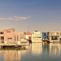
In the Netherlands, we focus mainly on preventing floods with our system of flood defences but we also think about possible responses if something unexpected does go wrong. Various steps can be taken limit the impact of flooding. In the Netherlands we distinguish between two categories: measures to mitigate consequences (including water-resilient building, floating buildings, elevated buildings and not building in very exposed areas), and measures to improve flood disaster management (such as the drafting of disaster plans, evacuation drills, communications for local inhabitants).
A more in depth answer
How climate-robust are our waterways and infrastructure?
The Meuse is an important shipping route. Ships move through a number of locks to bridge differences in the water levels between the river and the canals. A fixed water level is maintained along the entire Meuse Route for most of the year so that shipping is not affected by low discharges. When discharges are high, the weirs are opened and shipping can pass through unhindered. Higher discharges are a problem for shipping because there is less vertical clearance under bridges and container shipping has to reduce the number of layers of containers on board. During high discharges, recreational and commercial shipping can be obstructed because of the high flow rates and the presence of floating debris. High discharges will become more frequent as a result of climate change, with consequences for shipping as a result.
A more in depth answer
How can summer peaks of this kind be taken into account when designing the new weirs on the Meuse?
The Meuse has a large number of weirs that, under normal circumstances, raise the water level for shipping so that there is enough draught. During periods of high water, the weirs have to be opened because the water level has to be kept as low as possible. The weirs in the Dutch section of the Meuse are almost 100 years old and they will be replaced or renovated from 2028 onwards as part of the national Replacement and Renovation programme. The original design for the current weirs takes a maximum river discharge of 3200m3/s into account; higher discharges will have to included in the design parameters for the replacement weirs.
Has the high water altered the bed of the Meuse?
Riverbeds change as a result of erosion and sedimentation. Erosion occurs where the flow concentrates and accelerates; sedimentation where the flow fans out and slows down. During high water, the flow follows a completely different pattern than it would in normal circumstances. The acceleration and slowing down of the flow are stronger and they are seen in different locations. The result is a mosaic of erosion and sedimentation along the river. In the summer bed, the old bed position gradually recovers later when the normal discharge regime returns.