Latest addition to San Francisco Bay-Delta Community Model: simulation of extreme water levels
Expert(s) |
Mick van der Wegen
Dutch and American scientists and engineers created, applied and shared a new Delft3D Flexible Mesh model that focuses on the simulation of extreme water levels in the San Francisco Bay-Delta system. The results have been published in the scientific journal 'Coastal Engineering' recently.
Open source platform
The San Francisco Bay-Delta system is complex in its physical and environmental dynamics. Modeling tools integrating hydrodynamics and water quality dynamics are essential to unravel the governing processes. This is relevant to assess potential shifts due to climate change and management strategies. There are several available San Francisco Bay-Delta modeling systems developed throughout the years for various purposes. However, a vast majority of these models are not easily accessible or practical for public use. The San Francisco Bay-Delta Community model platform facilitates and enhances interdisciplinary and interagency scientific communication, collaboration, and understanding. This open source platform allows users to quickly get up to speed using a well-supported modeling framework.
Simulation of extreme water levels
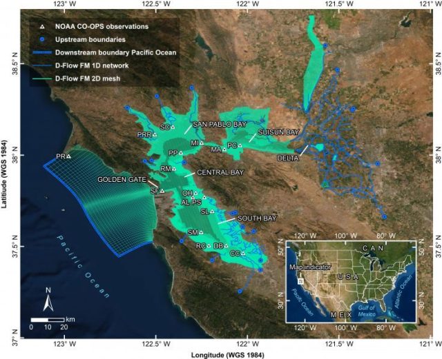
The latest addition to the San Francisco Bay-Delta Community is the 1D-2D hydrodynamic model that focuses on water levels. Scientists and engineers from Deltares USA, Deltares Netherlands, United States Geological Survey (USGS) and Alameda Flood Control District created, applied and published a new Delft3D Flexible Mesh model that focuses on the simulation of extreme water levels in the San Francisco Bay-Delta system. The unstructured grid with 1D-2D model elements allows for efficient and fast model simulations. Results from a recently published paper (Nederhoff et al., 2021) show significant accuracy in reproducing observations for the entire modeled period with an average root-mean-square error of 8.0 cm. A process-based modeling approach allows for the explicit in- and exclusion of different physical processes to quantify their importance to the extremes. For the 100-year still water level, tide (70%) and non-tidal residual (NTR) (25%) explain the majority of the simulated high water levels in the Bay relative to Mean Higher High Water (MHHW). However, closer to the Delta, local fluvial inflow increases in importance. For longer return periods, the importance of tide decreases and the importance of remote NTRs and fluvial inflow increases.
Promising results
The same Delft3D Flexible Mesh model is also currently utilized in a newly developed forecast system as part of a collaborative project between National Oceanic and Atmospheric Administration (NOAA), USGS, California Department of Water Resources (DWR), and several other stakeholders. As part of this framework, the model has been coupled with the latest meteorological, fluvial and oceanic forecasts to predict coastal flooding in San Francisco Bay to achieve the ultimate goal of providing the public with an accurate coastal and inland flood forecast system. The forecast system's initial results have been promising, and it will be available to the public by the end of 2022.
Some other applications of this new model and subsequent results are 1) simulating water level across the San Francisco Bay-Delta for current and future sea-level rise scenarios and 2) assessing the impact of planned flood protection scenarios across the San Francisco Bay-Delta for extreme tidal and non-tidal events. For more information and for all the data and science, please visit www.d3d-baydelta.org. Anyone can use the model as a backbone for their planning studies.
--------------------------------------------------
Publication: Nederhoff, K., Saleh, R., Tehranirad, B., Herdman, L., Erikson, L., Barnard, P. L., & van der Wegen, M. (2021). Drivers of extreme water levels in a large, urban, high-energy coastal estuary – A case study of the San Francisco Bay. Coastal Engineering, 170, 103984.