Sand from the North Sea – the Minerals Information System
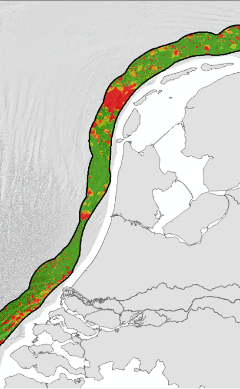
Deltares is working with TNO and on behalf of Rijswaterstaat on the Minerals Information System (DIS), which will provide a picture of how much sand can be extracted from the North Sea. Since 2019, we have been working on a major update to version 3.1. It draws on a lot of new data which was not used in previous versions. The most recent version has been completed for the provinces of Zeeland and Zuid-Holland; work on the rest of the coast will take place in the years to come.
Preparing for the future
Some 25 million m3 of sand is extracted from the North Sea every year to protect the Dutch coast and for commercial purposes. To maintain this supply in the future, particularly against the background of the expected sea level rise due to climate change, it is critical to understand how much sand is available, and in which locations.
The availability of suitable sand
Availability depends to some extent on geological considerations. Where is usable sand present on the surface of the bed and at which depths do these areas include clay or other undesirable layers that make it unsuitable for extraction? In addition, there are many other activities in the North Sea that make sand extraction impossible. Examples include the development of offshore wind farms and the associated cable routes to the coast, shipping and nature.
3D model
To map out the extractable sand, a geological interpretation is being conducted for the DIS of a dense network of seismic profiles that are combined with all the bore data along the Dutch coast. On that basis, a 3D voxel model is being developed that can be used to determine the layer thicknesses of sand packages and therefore, ultimately, the volumes of extractable sand, taking into account other uses in the North Sea.