Floods in Southeast Asia better captured with satellite data over the past 8 years
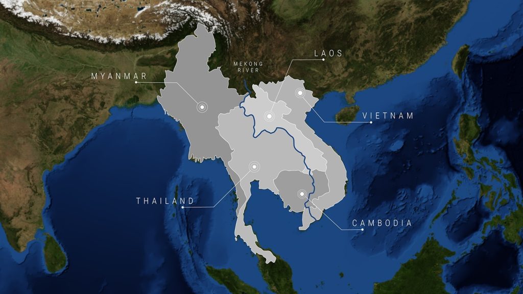
Home to over 250 million people, Southeast Asia is one of the most dynamic regions in the world. With growing economies, diverse landscapes and vibrant communities, Southeast Asia contributes to its region’s food security as well as a quarter of the world’s rice exports. The 3,000 kilometre long Mekong River flows through different countries of Southeast Asia, being the third longest river of Asia. The river is not just a source of life and income for the local population, but also to the world through the abundance of fresh water, fish and gigantic rice production taking place within its basin.
Near-real time data
Through climate change and changing landscapes, the population within the region experiences more floods as well as droughts, which have a large negative impact on their lives and livelihoods. As more and more floods and droughts will occur, the need for (real time) information around these disasters is increasing. Through satellite data we made it possible to monitor and forecast those floods and droughts near real-time with increasing accuracy.
With SERVIR Mekong we have integrated satellite data into publicly accessible tools that improve and strengthen locally developed and sustainable solutions to address the climate crisis. From 2014 to 2022, SERVIR-Mekong developed 21 decision support tools, trained over 1,500 people, mobilised $500,000 of additional investment, and influenced the adoption of four policies to ensure that the 250 million residents of the Lower Mekong Region are better prepared to respond to the impacts of climate change.
The hub
Deltares has worked the last 8 years on making available and improving satellite-derived data within the SERVIR-Mekong project together in a consortium of 4 parties. The hub lead is the Asian Disaster Preparedness Centre (ADPC), which works with the Spatial Informatics Group (SIG), Stockholm Environment Institute and Deltares. SERVIR is a program of NASA and USAID, with several regional hubs active across the globe.
ADPC will implement SERVIR-Southeast Asia in collaboration with USAID, NASA, as well as other regional organisations such as the ASEAN Secretariat, the Mekong River Commission, and other international organisations (like Deltares). It will ensure that SERVIR-Southeast Asia meets its objective of: “expanded and scaled climate actions by using satellite data and geospatial information for decision making.
Hans Guttman, Executive Director of ADPC
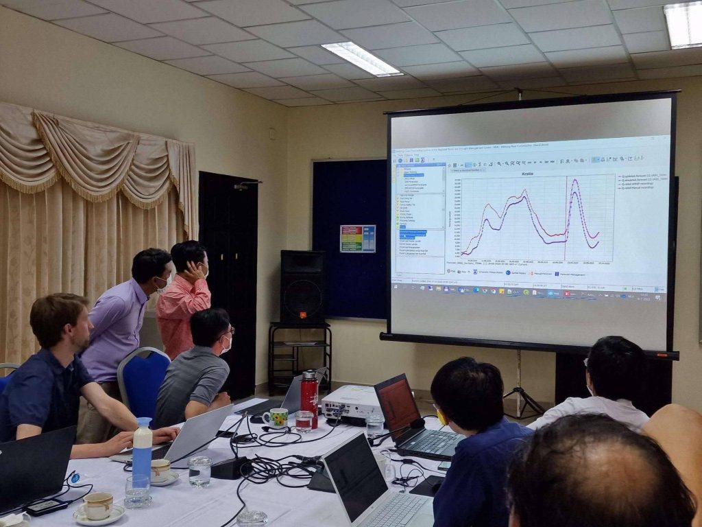
Deltares has been active across various tasks within the projects, including the development of algorithms for the accurate detection of water and floods from satellite data, training consortium-members in the use of Google Earth Engine (GEE), building of web applications to disseminate relevant information, improving the regional flood forecasting system (FEWS-Mekong) and implementing operational applications for different end users.
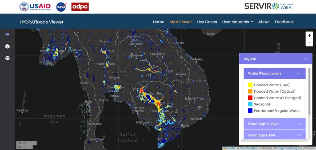
One of the applications, called, HYDRAFloods, is a publicly available, web-based service delivering near-real time information for improved flood monitoring.
SERVIR-Mekong proves the value of cross-disciplinary collaboration at global scale, by making a regional institute leading the execution and support them with specialist knowledge from NASA and other parties, including Deltares, combined with a focus on impact-driven research directly benefiting end-users.
Arjen Haag, project lead at Deltares.
Over this 8-year duration a lot of improvements have been made such as increasing the lead time for flood forecasts. As climate change intensifies and development accelerates, we will continue to work together in getting better and accurate information into the hands of those who need it most in order to make them more resilient and adaptable. This includes organisations like the United Nations World Food Programme in the region, with whom we’ve co-created our operational and near real-time flood mapping service.
Open science policy
SERVIR’s open science policy aligns very well with that of Deltares; research and algorithms are published in open-access journals, algorithms and tools are hosted online with open source licenses.
You have not yet indicated whether you want to accept or reject cookies. This means that this element cannot be displayed.
Or go directly to: