Paramaribo Drainage management project
The Government of Suriname is implementing the Saramacca Canal System Rehabilitation Project (SCSRP) with a loan from the World Bank. The project aims to reduce the flood risk for people and assets in Greater Paramaribo and to improve flood resilience. Component 1 of the SCSRP project is the rehabilitation of the Saramacca Canal sluices and locks, and canal reprofiling. Component 2 is the present project, updating parts of the 2001 Paramaribo drainage Master Plan, including developing and updating design standards, norms and guidelines for efficient planning and management of the Saramacca Canal drainage system. This second component is carried out by Deltares (lead partner) in a Joint Venture with Royal Haskoning DHV and with subcontractors Ilaco N.V. (Suriname) and Kavel10 BV (Netherlands).
Problem statement
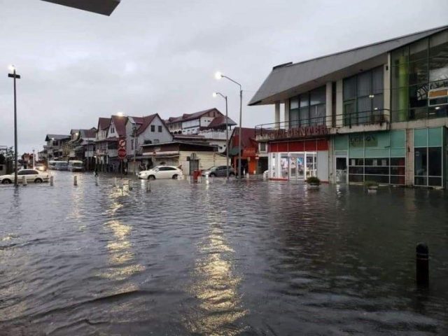
The Greater Paramaribo project area is about 600 km2 and drains to the Suriname River through a combination of open channels and closed sewers. The Saramacca Canal plays an important role in the drainage system, draining an area of approximately 190 km2, of which 70 km2 is heavily urbanised. The city has been growing and is expanding and is prone to pluvial flooding. During heavy rainfall, flooding of properties and roads occurs quite regularly, most recently in May 2021 (see photos).
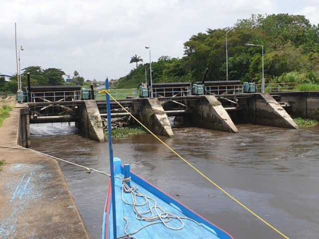
Climate change, with intensified rainfall events and sea level rise (resulting in higher water levels on the tidal Suriname River, limiting drainage options), and possible subsidence will increase the flood risk for the whole Greater Paramaribo area. The relatively poor condition of the general drainage network, including primary (Saramacca Canal), secondary and tertiary canals and outlet structures to the river, is an important factor determining the occurrence and severity of flooding.

Project activities and results
The present project led by Deltares will update parts of the 2001 Masterplan. Among others, we will develop a detailed LiDAR based DEM (an activity of subcontractor Kavel10), set up new hydrological and hydraulic models to produce flood hazard and risk maps for present and anticipated future (2040) conditions, and develop a vision on the further development of the drainage system for Greater Paramaribo.
The project will develop an Integrated Flood Risk Management Plan for Greater Paramaribo. We will identify the potential and limitations of gravity versus pumped drainage options. Structural and non-structural measures including combinations of ‘green’ and ‘grey’ measures, and options for improved maintenance, will be identified. The identified possible measures will be evaluated based on costs, benefits (including reduced flood risk), social and environmental impacts.
This leads to a list of prioritized investment interventions. For 2 selected pilot areas, the plan will be worked out in more detail. Interaction with and involvement of the Ministry of Public Works, World Bank, and various local stakeholders like other government agencies, local authorities, NGOs and other local organisations is a crucial point of attention during the whole project.