Geophysical facilities: measuring where space is still available
The researchers in the geophysical facilities work with others to develop and test measurement and monitoring techniques, producing targeted, geological and geophysical information about the subsurface and groundwater. This information helps clients to get to grips better with what is possible and what is going on in the subsurface. And how that is changing as a result of climate change or interventions in that subsurface.
It also shows which alternatives are available for new and existing infrastructure. This is relevant because the available space is more limited than ever. At the same time, demand for space continues to be high. Where there used to be space to lay cables or pipelines below the surface, things are extremely congested these days. That clashes with the wish to build wind farms as part of the energy transition, or other infrastructure.
Forecasting changes in the future
‘Clients want forecasts about changes in the future’. Clients such as government and semi-government bodies, research institutes, contractors, mineral and water extraction, project developers and consultancy firms very much want to know what is located there. And what the consequences are for railway tracks, dikes or pipelines if something starts vibrating or subsiding somewhere. For example as a result of construction work, or long periods of wet weather or drought. ‘By contrast with the past, climate change and the energy transition mean that clients also turn to us more often with requests for predictions about changes in the future,’ says Deltares expert Chris Bremmer.
By contrast with the past, climate change and the energy transition mean that clients also turn to us more often with requests for predictions about changes in the future.
Chris Bremmer
Fibre-optic cables alongside railways in geophysical surveys
Our geophysicists answer those questions using the geophysical facilities. The facilities provide our researchers with geophysical technologies. We use them to map out spatial variation in the subsurface efficiently and accurately. Other geophysical and geological technologies are used to describe the subsurface or locate specific features.
Examples of the use of technology in geophysical research are seen in the use of the latest fibre-optic cables alongside railways. Those cables allow us to measure vibrations from passing trains and provide us with information about the characteristics of the subsurface. In that way, the client knows exactly when management and maintenance are needed.
Technologies at the geophysics facilities and the co-creation of knowledge
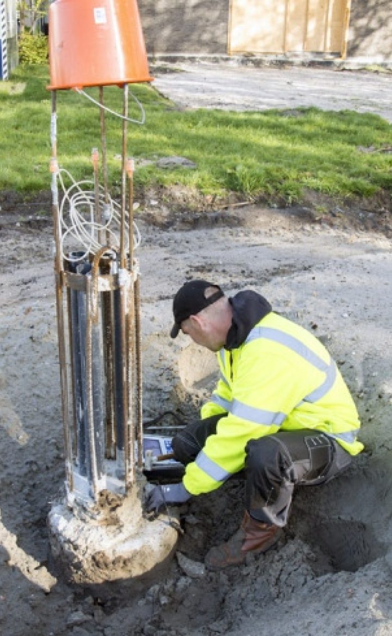
Electromagnetic measurements (EM-31, ERT, ground penetrating radar) are used to measure fresh/salt and dryness, and how these characteristics evolve. For example in research looking at the possibility of using brackish water as a drinking water supply. Optical glass fibres continuously measure the temperature and direction of groundwater around the wells so the client knows where the groundwater is coming from.
Geo-electrics (resistivity including tomography, IP and SP) and borehole monitoring are also used. Deltares has developed software for dike monitoring that allows bores to be combined with geophysical measurements to build up a 3D picture of the structure of a dike, providing you quickly with a clearer understanding of the subsurface.
We conduct measurements ourselves or in co-creation with third parties, as in offshore projects. In that way, we can always use the most advanced measurement technologies. We draw on the data to look at the subsurface and what is happening there. We deliver the results of the research - accompanied by an explanation and clear visualisations - to the client. Our guiding principle is to examine each question individually to see which combination of technologies and knowledge will deliver the best result for the particular project. Field observations, and geological and geohydrological knowledge, play an important role in the integration of all measurements, observations and knowledge.
Geophysical facilities link the available data
It should be pointed out that data do not necessarily need to be obtained from new measurements. The amount of available data has increased due to the increasing availability of data sensors such as satellite images and fibre-optic cable technology. Data have also become cheaper. Using new techniques based on machine learning, we comb the data to identify patterns and determine changes in subsurface properties more accurately.
On the basis of the research question, we determine whether new measurements are needed or whether data are already available. Or whether the answers can perhaps be found by linking existing datasets and different measurement techniques. This improves quality and accuracy, and fits in well with clients’ questions about where there is space for infrastructure and how best to integrate it in the locality.
We determine a long time in advance what a client needs to be able to get the job done. We use predictive modelling for that purpose. Our researchers determine the parameters and the most realistic conditions. That helps to deliver the most accurate information that is the best fit for the research question.
Chris Bremmer
GeoProrail project
In co-creation with Prorail, we are investigating whether the fibre-optic cables alongside the railways can be used as real-time sensors. When trains pass by, they cause vibrations in the fibre-optic cables that are already in place for telecommunications. This provides a picture of the subsurface that allows ProRail to identify any changes such as subsidence. They can then take the appropriate action.
The method is cost-effective, safe because people don’t have to walk along the track, and fast. Boring can also be used alongside this approach if more detailed information or validation are needed.
Research for Dunea
Our geophysicists investigate brackish water extraction using a range of geohydrological measurement technologies. The question is whether brackish water can be used as one of the potential sources of drinking water for the Netherlands. We are also looking at whether the water will become too salt if too much water is extracted. The study combines measurements, data-driven modelling and a numerical model. Each of these elements provides specific information which, in combination, yields a complete picture as a basis for the best possible forecasts.
We develop software for water authorities and business that make it possible to combine geophysical measurements, boring and geotechnical probe testing very efficiently. This makes it possible to produce, and easily update, accurate 3D models of the subsurface and dikes.