
IPCC data on coastal flood risk on BlueEarth
The recent IPCC report states that sea level rise poses a distinctive and severe adaptation challenge. It implies dealing with slow onset changes and increased frequency and magnitude of extreme sea level events, which will escalate in the coming decades. Such adaptation challenges would occur much earlier under high rates of sea level rise. Data on the projected population at risk to coastal flooding is now available on Deltares’ BlueEarth Data platform, a web-based application supporting the study and sharing of integrated water and subsoil-related data.
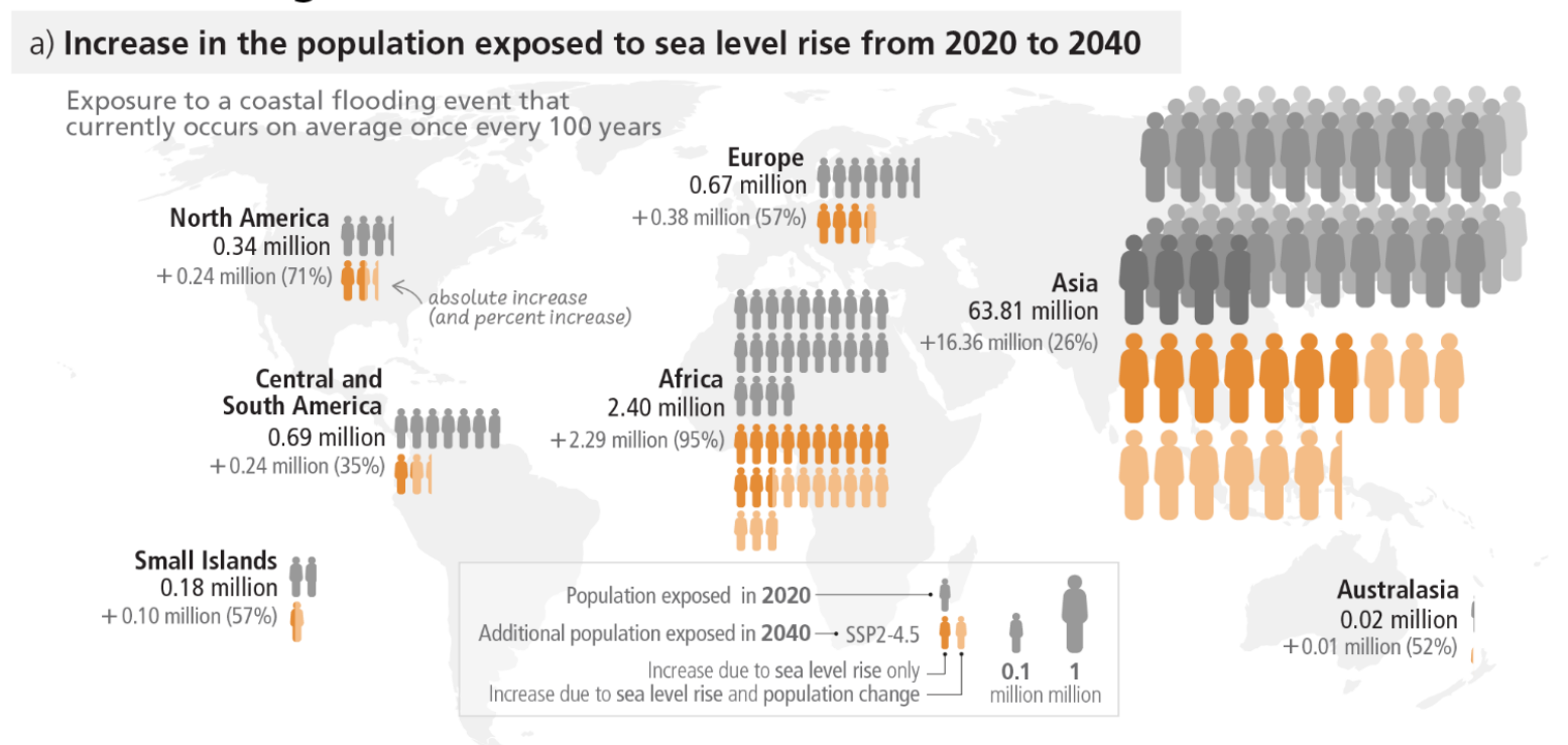
The IPCC report uses this data first to show that the population potentially exposed to a 100-year coastal flood is projected to increase by about 20% if global mean sea level rises by 0.15 m relative to 2020 levels. This exposed population doubles at a 0.75 m rise in mean sea level and triples at 1.4 m without population change and additional adaptation. Using the sea level rise scenarios from the IPCC working group I the timing of exceedance of risk increase can be assessed.
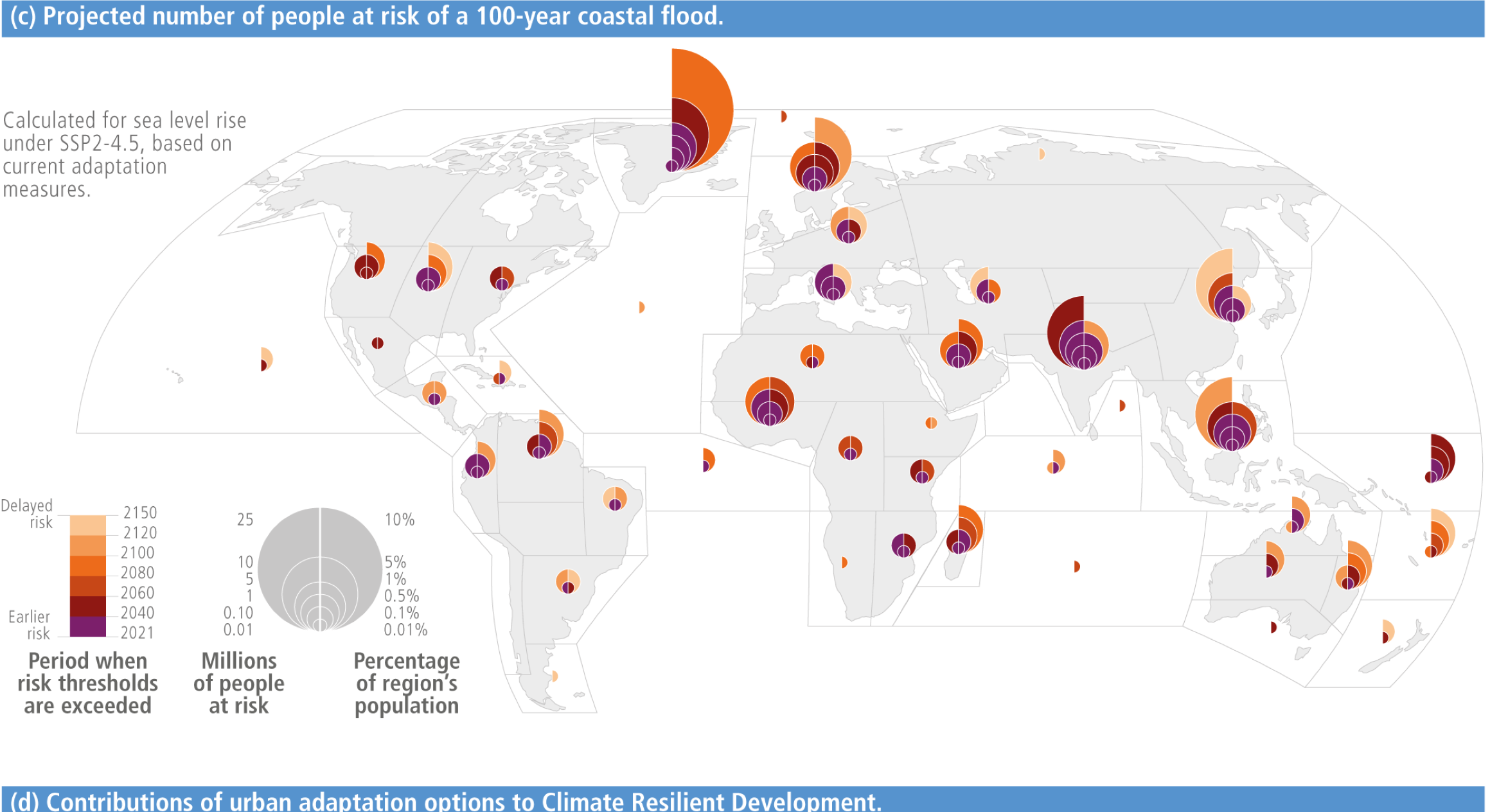
Based on, amongst others, this data the recent synthesis report also highlights that increasing urbanisation in low-lying and coastal zones will be a major driver of risk increase to sea level rise.
BlueEarth Data
It is now also possible to explore the data from multiple scenarios in BlueEarth Data platform. The BlueEarth Data platform, developed by Deltares, is a free, web-based application designed to facilitate the study and sharing of integrated water and subsoil-related data. Primarily intended for professional specialists and researchers, the platform offers indicative data through a multi-data viewer, covering various themes such as Flooding, Coastal Management, and Offshore. Users can access global datasets, visualize spatial maps and time series, and even download selected data after registration.
”We are delighted to host the IPCC data on populations at risk of coastal flooding due to a 100-year event on our platform. Our aim is to provide users with the opportunity to engage with this crucial data in greater detail,” says Björn Backeberg, Deltares expert and product owner of the BlueEarth Data Platform.
Deltares researcher Gundula Winter: "I am very excited that we can share the full dataset through BlueEarth now. In the IPCC report, we could only present a subset of the data. BlueEarth allows people now to access the whole dataset and compare scenarios for different Shared Socio-economic Pathways".
A detailed description of the methods and references can be found in the original paper, in Climate Risk Management issue 34 (Long-Term Sea-Level Rise Necessitates a Commitment to Adaptation: A First Order Assessment).