CoCliCo: a digital leap forward in coastal safety
Imagine being able to instantly see which coastal areas in Europe are most vulnerable to flooding. And imagine if policymakers, urban planners and insurers could use that information right away to make smarter decisions. That’s exactly what CoCliCo enables: an open-source web platform that provides clear insights into current and future coastal risks—from sea level rise to storm surges and erosion.

From abstract threats to tangible insights
Sea levels are rising. But what does that mean for a city like Valencia, or a low-lying polder in the Netherlands? The potential impact of flooding is a major concern across Europe, where much of the infrastructure is located near the coast or in low-lying areas.
CoCliCo Services – short for Coastal Climate Core Services—is a digital climate tool that translates complex climate data into accessible maps, graphs and scenarios. Users can explore, for example, what percentage of a municipality could flood under a given climate scenario, how many people or buildings might be affected, and what the potential economic impact could be. These insights help cities, policymakers and other stakeholders to take timely action to reduce risks.
This isn’t a real-time alert system, but a “pre-cooked” tool: all data is pre-processed and presented in clear, layered formats. That makes it ideal for long-term planning and policy development.
Rijkswaterstaat and the water authorities are continuously working to identify current and future flood safety risks. In the future, the techniques developed in CoCliCo may be used to support this effort.
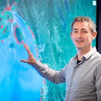
Quirijn Lodder, water safety advisor at Rijkswaterstaat
“We wanted to make the impact of climate change tangible,” says Arjen Luijendijk, expert and CoCliCo project lead at Deltares. “Not just for scientists, but especially for policymakers and city residents. If you can show what might happen under a certain scenario, you can really initiate change..”
Deltares at the heart of the project
Deltares played a central role in developing the platform’s core: the web viewer, the underlying cloud architecture, and the integration of user stories.
“We were truly the spider at the centre of the web,” says Etienne Kras, researcher at Deltares. “We worked closely with technical development teams, data providers and end users. That allowed us to design the platform based on real user needs.”
The result is a digital service that’s not only technically robust but also tailored to the information needs of policymakers and local communities.
Ease of use was a key priority. Rather than overwhelming users with data, the team chose to include only the datasets that support the platform’s narrative—such as flood maps, population projections, infrastructure data and cost-benefit analyses of adaptation measures.
In the real world, there are no hard boundaries between hazards and impacts, or between short- and long-term timelines. Everything is interconnected. CoCliCo is a step forward in bringing these elements together in our coastal analyses and planning.
Bart van den Hurk, scientific director at Deltares and climate expert within CoCliCo
Science that works
What makes CoCliCo stand out is its integrated approach to data and scenarios. The entire risk assessment chain—from sea level projections to economic damage—is built on consistent parameters and timeframes. This allows for meaningful comparisons between regions and supports cross-border collaboration on shared challenges.
The platform is FAIR (findable, accessible, interoperable, reusable), cloud-based and scalable. Researchers can dive into raw data via a dedicated workbench, while policymakers benefit from an intuitive interactive viewer. CoCliCo bridges the gap between science and decision-making.
“The beauty of the platform is that all layers talk to each other,” Arjen explains. “You don’t just see where the risk lies—you also understand what it means for people, buildings and infrastructure. That’s powerful for decision-making.”

Impact and momentum
Within three weeks of launch, the platform attracted 1,400 users. Analytics show widespread interest from across Europe.
“We saw immediate engagement from cities like Malmö, where climate adaptation is a top priority,” says Etienne. “That confirmed we’ve built something that truly resonates.”
CoCliCo is currently at technology readiness level (TRL) 6: a working prototype that functions in real-world settings and is being further developed. Thanks to its integration into the European EDITO programme, the platform will remain available and continue to evolve. Deltares is also exploring how CoCliCo can support consultancy and advisory services—for example, helping cities prepare for rising sea levels.
We haven’t just built a platform—we’ve laid the foundation for better decisions about our vulnerable coastlines, using the latest digital tools.
Arjen Luijendijk, Deltares

The project builds on previous initiatives like BlueEarth Data. Although that project has concluded, it provided valuable insights that directly contributed to CoCliCo’s success. The knowledge, technical architecture and stakeholder approach have all been refined and integrated into the current platform.
Deltares as knowledge partner
CoCliCo is designed for both technical and non-technical users. Deltares offers expert advice based on the platform’s data and insights. Municipalities, ports, national governments and insurers can immediately start working with scenarios, risk analyses and adaptation strategies.
“We see a strong demand for accessible tools grounded in solid science,” says Etienne. “With CoCliCo, that’s exactly what we offer: a bridge between data and action.”