Counting on water with data science
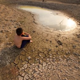
A shortage of water is something we prefer to avoid. Data science techniques and computer models help to establish a picture of supply and demand, whether for the next few days or weeks, or for a much longer period of time. Our ultimate aim is to prevent longer periods of water scarcity for people and nature: shortages of drinking water, food and energy are a risk for peace and security. That is, after all, why the United Nations has Sustainable Development Goals for water scarcity and water management (6 and 13).

Working with government and business, we are developing software tools and information systems that identify problems with water security, drawing on both our system knowledge and the latest data science techniques. That information results in a clear picture of the risks associated with water shortages and increases in water demand/use.
Visualising the consequences of water scarcity
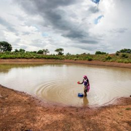
We clarify the impact on society of too little water for agriculture, drinking water, energy and shipping, for example. That helps authorities to promote sustainable water use and shows the effects of mitigation and adaptation measures. We also show that water availability should be a leading principle in decisions about land use. This is the only way to prevent bottlenecks in the future.
Through collaboration with a range of universities and the United States Geological Service, but also with organisations that include Google, Microsoft and IBM, we keep up to date with the latest worldwide developments in the data science field.
National, regional and plot-specific
Our systems support the Dutch government with information about water shortages, salinisation, and strategic groundwater resources. We recently took the initiative to establish a national platform for water shortages with government authorities, business and consultancy firms. With growers, Wageningen University and Research, and water authorities, we are working on digital predictions of water shortages at the level of specific plots of land.
With our ‘next-generation drought index’, we can compile relevant and timely information about drought and related risks, even in areas that lack enough data themselves. We do this by using our global hydrological forecasting systems, big data, earth observation, and data science techniques and models. Our work allows water management authorities, business and relief organisations to take appropriate steps in time to limit the negative effects of a drought.
The WaterLOUPE approach and dashboards visualise the risks associated with water shortages now for the more distant future (around 2050) for a wider public. Information about water availability in the future is combined with data about impacts. This provides a picture of action perspectives for both government and business, helping them to shape their sustainability goals.
Data reliability
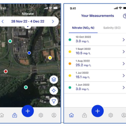
We validate most of the data we use with field measurements and/or by drawing on combinations of sources. Our approach is always transparent. For example, we share our work in the Digishape consortium and use the FAIR data principles. We have our own digital lab and a public cloud, but we also use Google Earth Engine, for example. We make our information available to the world in the Blue Earth Data community.
Information and action perspectives
It is our ambition to move ahead in the time to come on working data up into descriptions of drought risks and action perspectives. In collaboration with partners and stakeholders, we want to ensure that this information can be used when taking measures to prevent water shortages in the short and long term.